

MapTrace app for iPhone and iPad
Developer: Nasir Jeevanjee
First release : 08 Dec 2011
App size: 4 Bytes
#### A Great App for Map Lovers! ####
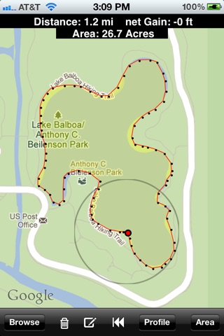
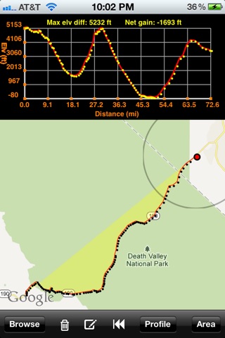
Have you ever wished you could quickly get the distance travelled, an area enclosed or an elevation profile of any arbitrary curvy path on a map? Have you ever wanted a scale while browsing a map? A flexible scale that can be moved or rotated? Well this is the app for you! This App can do all this and much more! This is the ONLY App in the store that computes the AREA on the MAP of a closed path of ANY SHAPE! Yes, just trace out any path with your finger along any geographical feature like a road, trail, mountain, house, river, lake or park and instantly obtain the distance, area and net elevation gain/loss. Tap a button and full elevation profile of the traced out path is plotted!
It is a great tool for somebody who wants to plan a walk or a jog for a specific distance, or a town planner, landscape designer, civil engineer or an architect for estimating distances, perimeters, areas and elevation profiles. Trace out the hiking/trekking trail and know your covered distance and the elevation gain. Even do geocaching, or even get the profile of a golf course to plan your next great shot!
Improved Area Calculation
Dismiss profile view on touch
Map rotates instead of scale
Area info always displayed